


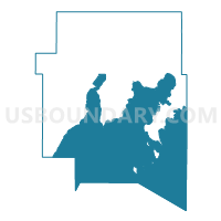
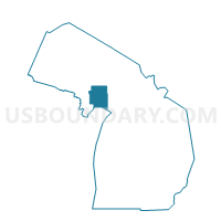
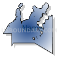
Voting Districts not defined, Delta County, Michigan
About
Outline

Summary
| Unique Area Identifier | 596318 |
| Name | Voting Districts not defined |
| County | Delta County |
| State | Michigan |
| Area (square miles) | 809.32 |
| Land Area (square miles) | 0.00 |
| Water Area (square miles) | 809.32 |
| % of Land Area | 0.00 |
| % of Water Area | 100.00 |
| Latitude of the Internal Point | 45.60352460 |
| Longtitude of the Internal Point | -86.79120960 |
Maps

Graphs
Select a template below for downloading or customizing gragh for Voting Districts not defined, Delta County, Michigan


Neighbors
Neighoring Voting District (by Name) Neighboring Voting District on the Map
- Voting District 0, Delta County, MI
- Voting District 0410604000001, Delta County, MI
- Voting District 0410998000001, Delta County, MI
- Voting District 0412614000001, Delta County, MI
- Voting District 0412636000002, Delta County, MI
- Voting District 0412636000004, Delta County, MI
- Voting District 0412696000001, Delta County, MI
- Voting District 0412938000001, Delta County, MI
- Voting District 0413140000001, Delta County, MI
- Voting District 0413230000001, Delta County, MI
- Voting District 0413230000002, Delta County, MI
- Voting District 0415222000001, Delta County, MI
- Voting District 0415650000001, Delta County, MI
- Voting District 0418524000001, Delta County, MI
- Voting District 1091424000001, Menominee County, MI
- Voting District 1537958000001, Schoolcraft County, MI
- Baileys Harbor - T 9999 Voting District, Door County, WI
- LIBERTY GROVE - T 1 Voting District, Door County, WI
- WASHINGTON - T 1 Voting District, Door County, WI
- Voting Districts not defined, Schoolcraft County, MI
- Voting Districts not defined, Menominee County, MI
- Voting Districts not defined, Leelanau County, MI
Top 10 Neighboring County Subdivision (by Population) Neighboring County Subdivision on the Map
- Escanaba city, Delta County, MI (12,616)
- Gladstone city, Delta County, MI (4,973)
- Wells township, Delta County, MI (4,885)
- Escanaba township, Delta County, MI (3,482)
- Ford River township, Delta County, MI (2,054)
- Masonville township, Delta County, MI (1,734)
- Liberty Grove town, Door County, WI (1,734)
- Brampton township, Delta County, MI (1,050)
- Thompson township, Schoolcraft County, MI (795)
- Garden township, Delta County, MI (750)
Top 10 Neighboring Place (by Population) Neighboring Place on the Map
Top 10 Neighboring Unified School District (by Population) Neighboring Unified School District on the Map
- Escanaba Area Public Schools, MI (20,175)
- Gladstone Area Schools, MI (9,485)
- Manistique Area Schools, MI (7,611)
- Gibraltar Area School District, WI (5,519)
- Stephenson Area Public Schools, MI (5,324)
- Rapid River Public Schools, MI (2,786)
- Big Bay de Noc School District, MI (2,260)
- Northport Public School District, MI (2,000)
- Washington School District, WI (708)
- School District Not Defined (Water), WI (0)
Top 10 Neighboring State Legislative District Lower Chamber (by Population) Neighboring State Legislative District Lower Chamber on the Map
- State House District 101, MI (92,671)
- State House District 109, MI (90,978)
- State House District 108, MI (87,266)
- Assembly District 1, WI (54,189)
Top 10 Neighboring State Legislative District Upper Chamber (by Population) Neighboring State Legislative District Upper Chamber on the Map
- State Senate District 35, MI (261,943)
- State Senate District 38, MI (261,728)
- State Senate District 1, WI (180,989)
Top 10 Neighboring 111th Congressional District (by Population) Neighboring 111th Congressional District on the Map
Top 10 Neighboring Census Tract (by Population) Neighboring Census Tract on the Map
- Census Tract 9704, Delta County, MI (5,528)
- Census Tract 9602, Menominee County, MI (4,088)
- Census Tract 9706, Delta County, MI (3,974)
- Census Tract 9707, Delta County, MI (3,752)
- Census Tract 9709, Delta County, MI (2,673)
- Census Tract 2, Schoolcraft County, MI (2,553)
- Census Tract 9702, Delta County, MI (2,369)
- Census Tract 1001, Door County, WI (2,212)
- Census Tract 9701, Delta County, MI (1,631)
- Census Tract 9901, Delta County, MI (0)
Top 10 Neighboring 5-Digit ZIP Code Tabulation Area (by Population) Neighboring 5-Digit ZIP Code Tabulation Area on the Map
- 49829, MI (17,347)
- 49837, MI (9,795)
- 49854, MI (6,469)
- 49878, MI (3,583)
- 49807, MI (3,390)
- 49887, MI (2,474)
- 49835, MI (802)
- 49894, MI (680)
- 49817, MI (615)